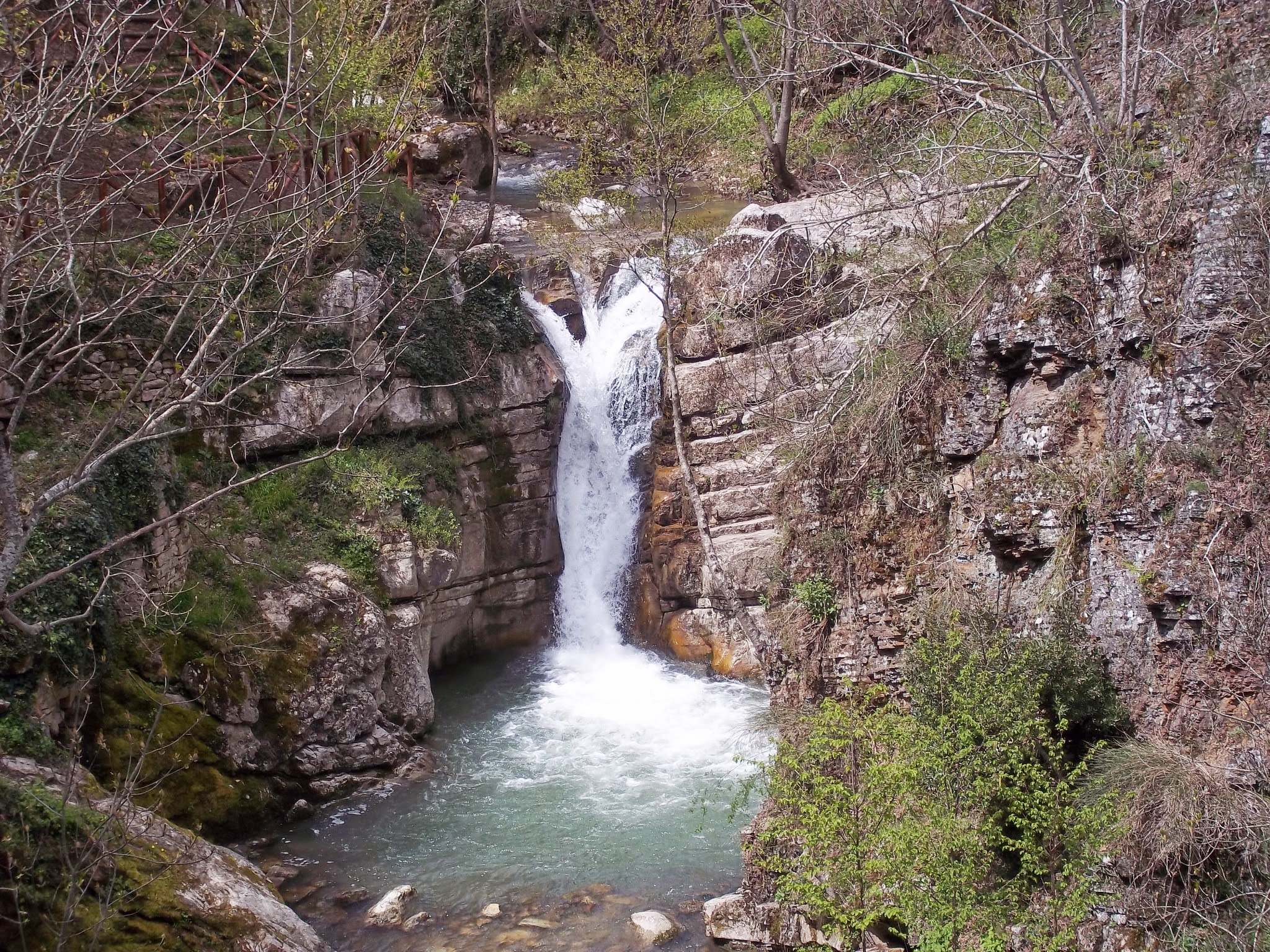
A series of different routes for an excursion to the San Fele waterfalls, in the northernmost area of the province of Potenza. It is indeed in Basilicata that this small naturalistic paradise is found which, thanks to particular jumps in altitude, gives life to a path of waterfalls that take their name from the homonymous locality, the village of San Fele, in the Comunità Montana del Vulture.
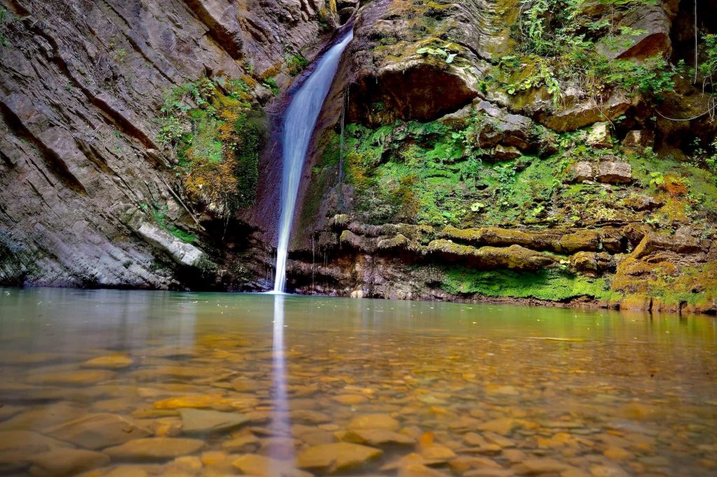
Known as San Fele waterfalls, the locals call them more specifically “U uattenniere”, dialect name of the Gualchiera, the machine that was used in ancient times to full wool by exploiting the power of water. As evidence of this activity linked to the waterfalls, in the area there are still remains of ancient water mills that were active until a little less than a century ago, in the XNUMXs. The San Fele waterfalls arise from the Bradano stream, or Bradanello to distinguish it from the river of the same name, in the Lucanian Apennines.
Its waters gush out in the territory of the municipality of San Fele, in the locality of Matise, to then flow into the fiumara di Atella and subsequently into the Ofanto river. In the uncontaminated area upstream of the town of San Fele the jumps in altitude give life to numerous waterfalls that make up this fascinating natural environment. Today enhanced and made accessible to the public who can admire it in its ancient and suggestive beauty. There The highest waterfall of this aquifer complex is that of "U urtone", 26 meters. It flows from one of the Bradano tributaries, in the Corbola valley.
Many naturalistic itineraries to admire the San Fele waterfalls
How to get there? Through old mule tracks which, thanks to the commitment of the Municipality and the inhabitants of the place, have become suggestive nature trails immersed in the greenery and silence of an environment where the jumps and the sound of the water are the great protagonists. To find out which path to take (or prefer), let's go to the discovery of main routes. The first, with a significant name Heaven, is the shortest. About 300 meters long, it allows you to reach the falls in about ten minutes.
The path called is also short The Twins because at the end of the route (about 300 meters) it allows you to reach the point where the Bradano and Acquafredda rivers meet, forming two twin waterfalls. The route is just under a kilometer long La Pineta, following the Bradano stream to discover the ruins of an ancient mill.
One kilometer of walking also for the paths U 'Urtone e Fosso d'Anna, walkable in about an hour. The latter is the route most linked to the ancient use of the waterfalls, which provided the hydraulic energy for the Gualchiera. The longest of all the trails is the one called The bridge. In fact, it runs for four and a half kilometers. It gives a broad view of the entire nature trail and passes through an old bridge built in the XNUMXs to create a quick link between the mountain and the town.
The excursion lasts about four hours and allows, by taking the path, to also enter the village of San Fele. A town almost 900 meters above sea level, perched between Mount Castello and Mount Torretta. The town is known, among other things, for the presence in its territory of one of the oldest and most mysterious sanctuaries in Basilicata, that of Santa Maria di Pierno.
Photo source in evidence Cascata U uattenniere (ph credit Aester88, CC BY-SA 3.0)